STAC in QGIS
QGIS is a powerful and popular geographic information system software that can natively access STAC since version 3.44.
Here is a step-by-step tutorial to perform the following:
- Generate an API key
- Set the API key in QGIS
- Configure a new STAC endpoint for the CDS MTD in QGIS
Generate an API key
To use the STAC Browser plugin in QGIS, you must first create an API key.
- Open this link in your web browser
- Click on “Generate an API key”
- Copy the
access-keyandsecret-key
(Note that you could also use the command line to generate a new API key: follow these instructions)
Set your API key in QGIS
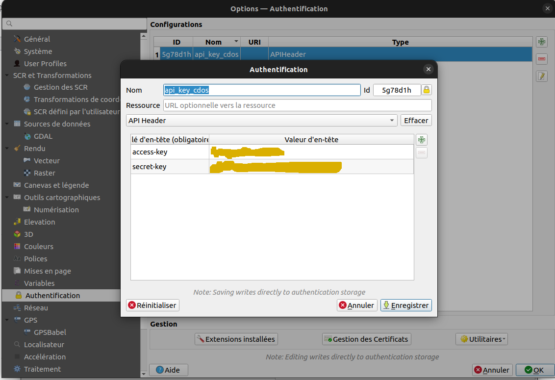
Once the API key is created, you have to set these credentials to the QGIS authentication framework.
- In QGIS, go to Preferences > Options
- Select Authentication tab on the left pannel
- If it has not been done, you must set a general password for QGIS authentication framework.
- Click on “+”, on the top-right of the panel
- Select API header, set a name (e.g.
CDS THEIA MTD Auth) and optionally a description - Use the “+” button on the top-right side of the table, to add the following keys/values:
- key:
access-key, enter the access key you have copied - key:
secret-key, enter the secret key you have copied
Configure a new STAC endpoint for the CDS MTD in QGIS
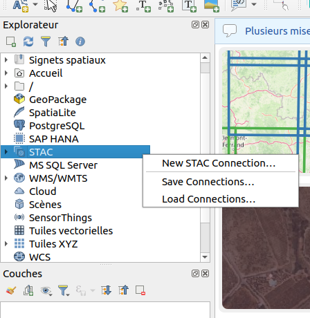
- From the Explorer left pannel, right clic and select New STAC connection, as shown in the figure below (Note that you can access this with the menu).
- Set the following:
    name: CDG-MTD
    url: https://qgis.stac.teledetection.fr
    authentication: select the authentication method that you have created previously (e.g. `CDS THEIA MTD Auth`)
Now you can play with the CDS-MTD STAC API! 🚀
Additional information
You can read this tutorial (in french!) that explains these steps and how to access the data, perform searches, filter using geospatial or temporal extent, etc.